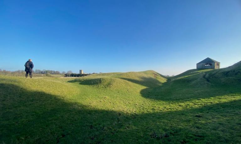
Bainbridge, North Yorkshire. COURTESY
In the church we catch sight of a 17th-century cavalier, ringlets cascading over his shoulder armour, rising on to his elbow as if disturbed from a long nap. Under the bell tower we discover stones incised with the shapes of broadswords, medieval faces and a Celtic whale. Then, emerging into the sunlight, we investigate the strange circular graveyard, wondering if this must have been a pagan site. From the shadows of ancient yew trees, a green bird bursts out, showing us the way down into a field full of furrows where a crystal stream burbles. Ahead of us on a turfed mound is a peculiar shrine.
“This is exactly what I want,” says my companion for the day, Carol Watson. “A good fort should be about exploration and discovery.” We are actually inside an ancient military encampment, an enormous one, with earthworks and ramparts covering about 300 hectares of fields and woodland near the North Yorkshire village of Stanwick St John, about six miles from Scotch Corner on the A1.
When Sir Mortimer Wheeler first excavated the site in 1951, he concluded that it was a massive fort built around the time of the Roman invasion of Britain by a tribal queen called Cartimandua. She famously sided with the Romans and, when the chance came, handed the rebel leader Caractacus over to them. Digs have turned up all sorts of objects: Italian glass, wine amphorae, chariot wheels, swords and, famously, the Meyrick helmet, one of only four iron age helmets to have been discovered in Britain (it’s now in the British Museum). More recently, a Durham University team uncovered a burial site in which a horse’s head had been placed on the body of an adult male.
Carol and I walk up through some impressive ramparts, then across empty fields to a line of trees. Here we pick up the line of the rampart again and find a section of wall that Wheeler had rebuilt to give an idea of the original wall. It is an impressive four and a half metres tall. We push on through undergrowth, following a faint trail that eventually ends at a faded wooden sign hand-painted with the word “Private”. Stanwick St John has many footpaths, but the site requires a bit of detective work and exploration, which is exactly what Carol wanted when she started the website Fort for the Day.
“Ever since I explored the Roman ruins at Bainbridge as a child, I’ve been fascinated by forts. Then during the first lockdown, while I was working for English Heritage at Richmond Castle, I started to realise that there were hundreds of forts marked on Ordnance Survey maps of Great Britain – sites that probably attract very few visitors, but are great to explore.”
The website she devised gives location details for a new fort every day of the year, plus links to OS maps to help users work out a walking route. Other links give an understanding of what’s there. After that, the exploration and discovery is up to you. There are few parts of the country where a fort cannot be found. Carol has many favourites: “Spitbank in the Solent and Inch Garvie in the Firth of Forth are wonderful. Cramond and Bo’ness near Edinburgh. Many places don’t even have names and you might not think there’s much to see, until you start exploring.”
Our own walk curls back round to the church of Saint John the Baptist, where we started, and the alabaster figure of Sir Hugh Smithson (d.1670), but we have barely scratched the surface. I can see there is a possible longer route around the outer perimeter. Stanwick itself remains slightly enigmatic, no doubt still hiding many secrets. What we do know is that around AD70, the fort was either abandoned or taken by the Romans. Then came layer upon layer of history, notably the Anglo-Saxon stones and the church’s handsome grave effigies. It’s been a fascinating day and I’m now determined to investigate a location I spotted years ago: a large earth mound near my house that is marked on the OS map simply as “Fort”. It’s about time I explored it.
St Ann’s Hill, Chertsey
It’s no surprise that forts were built at important crossroads, but this one turns up at the intersection of the M3 and M25. It’s a fine lookout point that has been used since prehistoric times, and over the years archaeological digs have produced flints and spearheads. In medieval times monks grew vines here. Later it was owned by the courtesan Mrs Armistead, who started her career working in brothels and later married Whig politician and dandy Charles James Fox. The site offers a nice woodland walk with views to the Chilterns – and Heathrow airport.
Bainbridge, North Yorkshire
Watson’s early inspiration boasts an impressive location: on top of an ice age drumlin. Around AD100, the Romans built a defensive position overlooking the confluence of the rivers Bain and Ure, with good views up and down Wensleydale. Stonework was added around AD190, but only the evocative ramparts survive. Carol’s favourite view of the fort is from the north bank of the Ure.
Oswestry Iron Age Hill Fort
One of Britain’s best-preserved iron age military installations, Old Oswestry Hillfort is a stunning spot with multiple ramparts on a 13-acre site north of the town. Human settlement here started around 1000BC, with a simple palisade fence that was added to over the centuries. After Roman times it was abandoned but seems to have become part of what is called Wat’s Dyke, a precursor to Offa’s Dyke, and now part of the 61-mile-long Wat’s Dyke Way long-distance footpath.


0 Comments